Shopping for timberland or a rural retreat in Douglas County and hearing “Umpqua basin” at every turn? You’re not alone. The watershed defines terrain, access, and markets in ways that directly impact cost, feasibility, and long‑term value. In this guide, you’ll learn how the basin is structured, how haul routes and mills shape your bottom line, and which rules and permits matter before you cut a road or a tree. Let’s dive in.
Umpqua basin at a glance
The Umpqua River system runs west across Douglas County, from Cascade headwaters through the Roseburg valley and out to the coast near Reedsport. Buyers typically think in three tiers: upper (Cascades headwaters and forks), middle (valley and lower foothills around Roseburg and Drain), and lower (Coast Range and near‑coast reaches). Each tier carries different terrain, access, and operating costs.
In broad terms, the forks and tributaries create a mix of steep headwaters, mid‑slope logging country, and lower‑gradient valley lands. Your plan, from buildability to harvest timing, should match the terrain tier.
Upper basin: Cascades terrain
High‑elevation country with steeper slopes and conifer forests sits in and around U.S. Forest Service lands. Soils are often thinner, roads are more expensive to engineer, and harvest systems can be specialized. Recreation value is high, but you should expect higher road construction and operating costs.
Middle basin: Valley and foothills
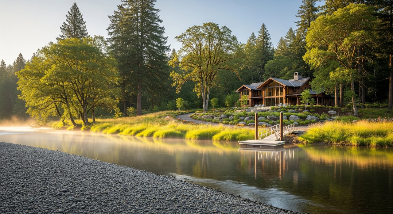
Around Roseburg and Drain, you’ll find rolling to moderate slopes, wider valleys, and alluvial benches. This is where private timberland is most concentrated and where mills and logistics are strongest. Deeper soils on benches and valley floors often support development and agriculture, while lower slopes help keep road and harvest costs in check.
Lower basin: Coast Range
Closer to the coast, the hills get steeper and more dissected, and weather is wetter. Haul routes are short and steep, often with seasonal constraints. If your tract depends on coast‑range roads, plan for wet‑season limits and more time on road maintenance.
North vs. South Umpqua corridors
Two forks shape much of the county’s buyer experience. Understanding their differences helps you match property goals to real logistics.
North Umpqua: Amenity and constraints
Substantial reaches of the North Umpqua have conservation and scenic designations, which elevate recreational and lifestyle appeal. With those amenities come tighter aquatic protections and steeper harvest logistics in many areas. Expect riparian buffers and careful planning around stream crossings.
South Umpqua: Market access and ops
The South Umpqua runs through the Roseburg area, where private timberland and mill infrastructure are more concentrated. This often means better access for commercial operations and more market options. If you’re selling timber, proximity to Roseburg’s processing cluster can improve delivered costs and net revenue.
Terrain, soils, and buildability
Slope and soil drive cost. On the Umpqua landscape, the cheapest build and road scenarios are usually valley benches and lower slopes. Mid and upper slopes may require engineered roads and more expensive harvest systems. On saturated soils and Coast Range slopes, wet‑season operations are restricted and erosion risks rise.
Fire risk also varies with terrain. Flatter valley or riparian areas differ from steeper uplands in mitigation and access needs. Your management plan should reflect those differences.
Ownership and access patterns
Douglas County is a mosaic of private industrial timberlands, family forestlands, state forests, and federal lands. That mix affects road density, access permissions, and sale opportunities. Around Roseburg, ownership blocks are larger and infrastructure is denser. Farther west, parcels are smaller and last‑mile access depends more on county or private roads.
Before you buy, confirm who maintains each road, where gates sit, and whether you have legal access across neighbors. Road class, maintenance, and seasonal closures directly affect haul cost.
Haul routes that shape costs
- Interstate 5 is the north‑south backbone through Roseburg, improving access to major markets and intermodal connections. Proximity to I‑5 generally lowers trucking time and wear.
- East‑west state highways and county roads connect the valley to the coast. Seasonal conditions vary, so verify route specifics with up‑to‑date maps before relying on any corridor.
- County and private logging roads handle the last mile. Long stretches of low‑speed gravel increase per‑load cost, and low‑capacity bridges can force partial loads or detours.
Mills, ports, and markets
Processing centers cluster around Roseburg, including sawmills and engineered‑wood facilities. Smaller mills, chip plants, and biomass facilities exist across the county but may have limited capacity and variable procurement. For export options, the Port of Coos Bay is the main regional deep‑water port for logs and chips, and rail or truck links influence viability.
Shorter hauls to mills and ports reduce delivered cost and improve net stumpage for sellers. Difficult routes or seasonal constraints can cut market options or force different truck types. Access to I‑5 and the Roseburg hub typically expands your buyer pool and improves price realization compared with coast‑range haul to the west.
Seasonal and operational constraints
Winter and early spring bring wet soil restrictions and seasonal road closures, which compress harvest windows and raise costs. Weight limits and bridge capacities can require smaller loads or longer detours. Depending on truck configuration and crossings, permits may be needed. Build these constraints into your timeline and pro forma.
Rules and permits that matter
The Oregon Forest Practices Act and Oregon Department of Forestry rules set the foundation for harvest planning, roads, riparian buffers, and fish passage. Where federal lands or ESA‑listed species are involved, additional consultation may apply. Douglas County planning and zoning control setbacks, rural zoning, floodplain rules, and county road access permits.
Many Umpqua tributaries support salmonids, so stream protections are a given in many locations. Fish‑friendly culverts or replacements may be required and can materially affect project budgets. Wetlands and riparian designations limit where you can build or operate, and some parcels include endangered or sensitive habitat or conservation easements.
Permitting for roads, crossings, and passage work can add months and significant cost depending on the scope. Engaging with ODF, the county, and, if relevant, the U.S. Forest Service early helps you avoid surprises.
Smart due diligence steps
Use a structured checklist so your offer reflects real logistics and regulatory cost.
Pre‑purchase technical checks
- Pull Douglas County GIS layers for ownership, zoning, roads, easements, floodplain, and known constraints.
- Review USGS topo and recent aerials to see slope classes, ridgelines, drainage, and existing roads.
- Request or commission a timber cruise, or at minimum a walk‑through with a forester.
- Get a road and access assessment covering maintenance, seasonal limits, bridges and culverts, and any off‑property road segments.
- Call local mill procurement to confirm acceptance specs, truck types, and preferred delivery points.
Permitting and environmental diligence
- Check ODF and USFS records for past notifications, riparian issues, or enforcement actions.
- Identify all stream crossings and determine fish passage status; price potential replacements or upgrades.
- Review FEMA flood maps and local wetland inventories to guide siting for structures and roads.
Logistics and market checks
- Map haul routes to nearby mills, chip plants, and the Port of Coos Bay. Note paved versus gravel segments, grades, and likely travel times.
- Ask for recent comparable harvests and haul distances in the immediate area.
- Evaluate road and culvert improvements you may fund to improve operations; quantify those costs before closing.
Cost and risk factors
- Seasonal closures and wet‑weather rules that shorten workable windows.
- Bridge and culvert capacities that force partial loads or alternate routing.
- Potential ESA or fish‑timing restrictions that affect scheduling.
- Fire risk and insurance implications for rural ownership.
Putting it together
Your best Douglas County purchase aligns terrain and access with your goals. If you want a lifestyle retreat with high amenity value, the North Umpqua corridor may fit, with the awareness that riparian protections and steeper slopes can increase costs. If your plan leans commercial, the South Umpqua and the Roseburg area often deliver better haul economics and more processor options.
A clear plan, a realistic budget for roads and crossings, and early conversations with mills and regulators are the difference between a smooth close and a costly reset. If you want a second set of eyes, we can help you focus on the right parcels, estimate real‑world haul and road costs, and reduce unknowns before you write an offer.
Ready to evaluate a tract in the Umpqua basin or want help mapping routes, harvest windows, and permit paths? Place your dreams in our hands — connect with David Brinker to talk through your next step.
FAQs
What is the Umpqua watershed and why it matters to Douglas County buyers?
- It is the west‑flowing river network that organizes terrain, access, and markets across Douglas County, shaping haul routes, operating costs, and development feasibility.
How do the North and South Umpqua corridors differ for buyers?
- The North Umpqua emphasizes amenity and stronger aquatic protections, while the South Umpqua centers on Roseburg’s infrastructure, often improving access and market options.
How does distance to Roseburg affect logging costs and revenue?
- Shorter hauls to the Roseburg processing cluster lower delivered costs and typically increase net stumpage, while longer or difficult routes erode margins.
What seasonal limits should I plan for when harvesting in the Umpqua basin?
- Winter and early spring wet‑weather rules and road closures compress operating windows, and weight limits or bridge capacities can force smaller loads or detours.
Which rules and permits most affect timber operations in Douglas County?
- The Oregon Forest Practices Act governs harvest, roads, and riparian buffers, with possible federal consultation for ESA species and county permits for roads and development.
What should I check about roads and stream crossings before I buy land?
- Confirm maintenance, seasonal closures, bridge capacities, and fish passage status for each crossing, and price any needed culvert replacements or upgrades into your offer.